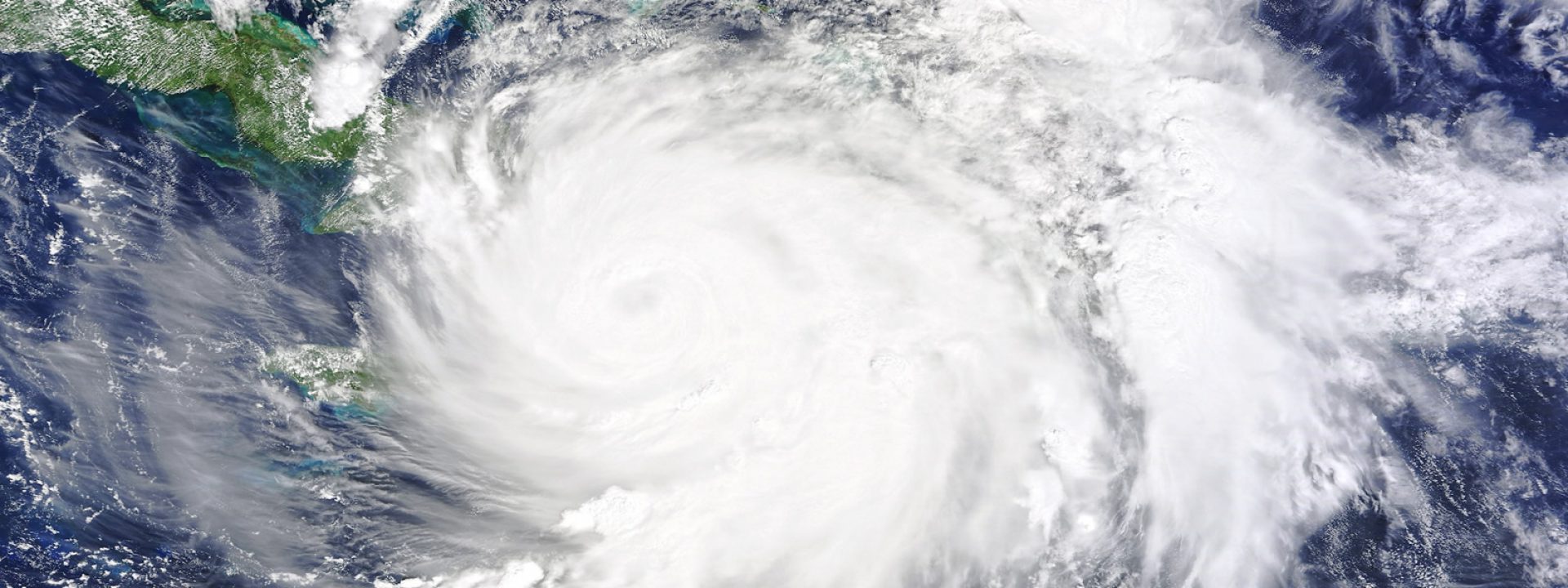
Until today, Matthew has been the most devastating hurricane this year: it has fully affected Haiti, where it has caused around 1,000 deaths and up to two million evacuees, also affecting Cuba and the USA severely. The enormous energy of the hurricane has caused winds of more than 250 kilometres per hour, five-metre high waves and torrential rains that have flooded entire neighbourhoods causing disastrous inundations. It has been the strongest hurricane in the Caribbean since 2007, according to the NOAA (National Oceanic and Atmospheric Administration), a key reference in the prevention of cyclones.
Depending on its force, a tropical cyclone may be defined as tropical depression, tropical storm or hurricane, which is the most severe degree. In the Atlantic Ocean, the season of tropical cyclones has officially started on the 1st June 2016 this year and will end on the 30th November. Since the start of the season, there have been fourteen tropical storms, six of whom have turned into hurricanes (Alex, Earl, Gaston, Hermine, Matthew and Nicole). Hurricanes are called typhoons in the Philippines and in China. The most notorious case was typhoon Haiyan that crossed the Philippines in November 2013, destroying the Visayas and the central region of the country with winds of 235 kilometres per hour. It was registered as the strongest typhoon ever to touch the ground and its consequences have been devastating.
The progression of Matthew was identified by the National Hurricane Center (NHC) on the 22nd September. The disturbance evolved until on the 27th it was classified as a tropical storm after a careful monitoring by satellite and with “hurricane chasers” planes. These aircrafts, manned by members of the air force and meteorologists, enter the eye of the storm risking their lives to collect data on wind, temperature and humidity.
The NHC warned of its danger and of its shift towards the northeast. On the following day, the storm was officially classified as a hurricane, being named Matthew. On the 30th September it reached category 5 (the highest) with wind gusts of 250 km/h.
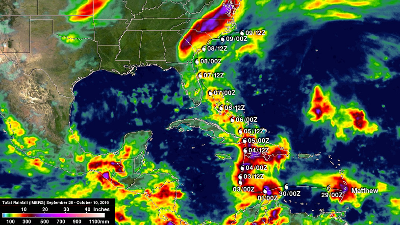
This image shows the trail of rainfall left by hurricane Matthew betweeen the 28th September and the 10th October. The most intense rainfall is identified by the purple colour. Haiti received the highest amount of water on the 4th October. © NASA/JAXA, Hal Pierce
A nuclear bomb every 20 minutes
During summer solstice, the 20th-21st June, the Sun is directly overhead the Tropic of Cancer (23º 26′ 14″ N latitude) and from that date on until the equinox (20th-23rd September) the zenith of the Sun covers the globe down to the equator (0º latitude).
This means that during summer in the northern hemisphere, the ocean water located in tropical latitudes collects a great amount of heat, causing the evaporation of large quantities of water that rises through the atmosphere. When the necessary height conditions are in place, the water vapour condenses and descends creating a tropical storm. If the disturbance travels north, it starts circling counterclockwise due to the Coriolis force caused by the earth´s rotation. If it starts finding enough hot water in its progression, the evaporation-condensation process increases and the winds that generate the cyclone turn at an ever-increasing speed and the storm becomes a hurricane.
The energy mobilized by this process was unimaginable until recently. Thanks to the research carried out a few decades ago by the National Center for Atmospheric Research (NCAR) we now know that a hurricane such as Matthew generates from 50 to 200 trillion watts per day, approximately the amount of energy liberated by the explosion of a 10-megatone nuclear bomb every 20 minutes, or 200 times the production capacity of electric power around the world.
Climate change as an aggravating circumstance
Tropical storms, cyclones and hurricanes are necessary phenomena for the climatic balance of the planet: they cool the surface of the ocean and in many cases reduce the effects of prolonged droughts. We need to see them as part of the water cycle.
However, scientists alert that climate change will progressively increase the violence of these phenomena while aggravating droughts. This polarization makes the earth very vulnerable to erosion and to the disastrous deforestation cycle.
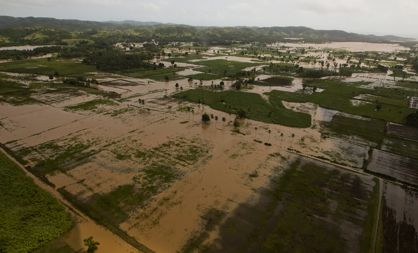
Flooded crops in Haiti after hurricane Matthew. © UN Photo/Logan Abassi
Prevention is not enough
The NOAA has become a reference in the prediction of tropical cyclones. Thanks to its National Hurricane Center, website devoted to real-time tracking of these huge oceanic disturbances, it has been possible to save many lives thanks to an increasingly precise prediction.
Prevision saves lives, but a proper management is essential. The rules set by the NOAA are the only internationally recognized ones and they are usually followed; you may see a summary of them in this website. The main problem some countries like Haiti have is that usually they lack resources to follow them properly and there is no management capacity. In Haiti there is also an aggravating circumstance: the country has been without government since February, experiencing a disastrous political chaos, just when the population was starting to recover from the terrible earthquake in 2010.
In this video by the NOAA you may see the basic messages that need to be transmitted to the population so that it may act. But not all of them may react this way.
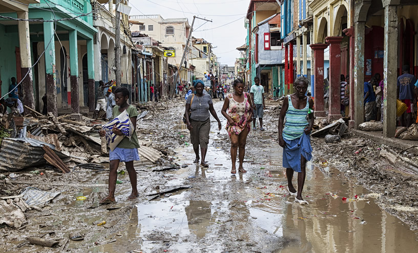
Devastation on the streets with many destroyed sanitation infrastructures. © UN Photo/Logan Abassi


